
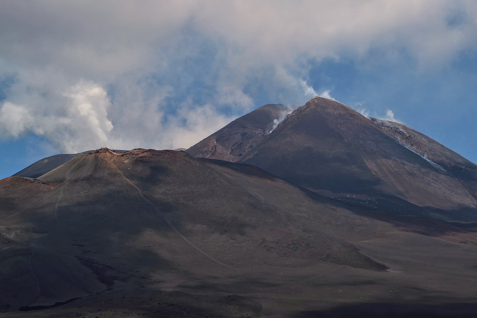
Hiking Mount Etna from Catania is the most popular day-trip on the eastern Sicilian coast — and the one most likely to surprise first-timers. Europe’s tallest active volcano peaks at roughly 3,357 m, has two access points (Rifugio Sapienza on the south, Piano Provenzana on the north), a 1960s cable car (Funivia dell’Etna), a strict 2,800 m altitude rule above which a certified volcanological guide becomes mandatory, and an early-morning AST bus that departs Catania at 8:15 a.m. once a day. Plan around those four facts and the rest falls into place.
We live 30 km from the volcano (easily reached from Taormina too), and we organise this guide the way locals plan it: pick your side first, decide whether you want the cable car or just the easy Crateri Silvestri loop, then check our guide on how to get to Mount Etna from Catania for bus timetables, driving directions, and cable car prices, then decide whether the AST bus or a rental car works best for you. Below are the five main routes by difficulty, what the cable car actually costs, what to wear, when to come, and when a guided tour is genuinely worth it.
Can you climb Mount Etna without a guide?
kuhnmi · CC BY 2.0
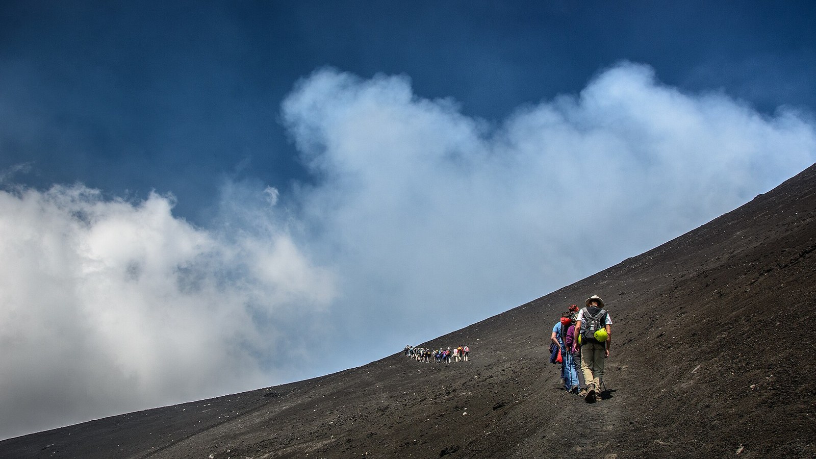
Yes — you can hike Mount Etna independently up to 2,800 m. Above that altitude, regional safety regulations require a certified mountain or volcanological guide because of unpredictable craters, gas vents, and lava flows. The 2,800 m line sits roughly 300 m above the cable-car upper station, so most below-summit routes are fully self-guided.
Skiing Etna in February? February typically delivers the deepest snow base of the winter — see our Sicily in February guide for the Sapienza vs Provenzana split-resort detail and festival pairings.
Hiking Etna in spring? May opens the best window of the year — trails below 2.000 m are snow-free, broom and orchids are in bloom — see our Sicily in May guide for the spring conditions and festival pairings.
The rule is enforced by the Parco dell’Etna and the Regione Siciliana: walk anywhere you like below 2,800 m, no permit needed, no entry fee. Above the line you have to be part of a tour led by a certified volcanological guide. In practice that means a few specific hikes are off-limits without booking: the Crateri Sommitali (summit craters at ~3,300 m), the Barbagallo Craters formed in the 2002–2003 eruption, and the historic Torre del Filosofo shelter at ~2,900 m. Everything else — the Crateri Silvestri loop, Schiena dell’Asino ridge, Monte Nero degli Zappini on the north side, the Valle del Bove rim — is yours to walk solo.
The reason the rule exists is straightforward: Etna is an active volcano. Gas vents shift after each paroxysmal phase, lava flows can re-route in hours, and micro-craters collapse without warning. Lonely Planet, AFAR and every operator on the mountain repeat the same line because it’s accurate, not because it’s marketing. If you want the summit area, book a tour; otherwise, lower routes give you everything else — lava fields, fumaroles, panoramic ridges, and the same volcanic ash underfoot — without paperwork.
SNappa2006 · CC BY 2.0
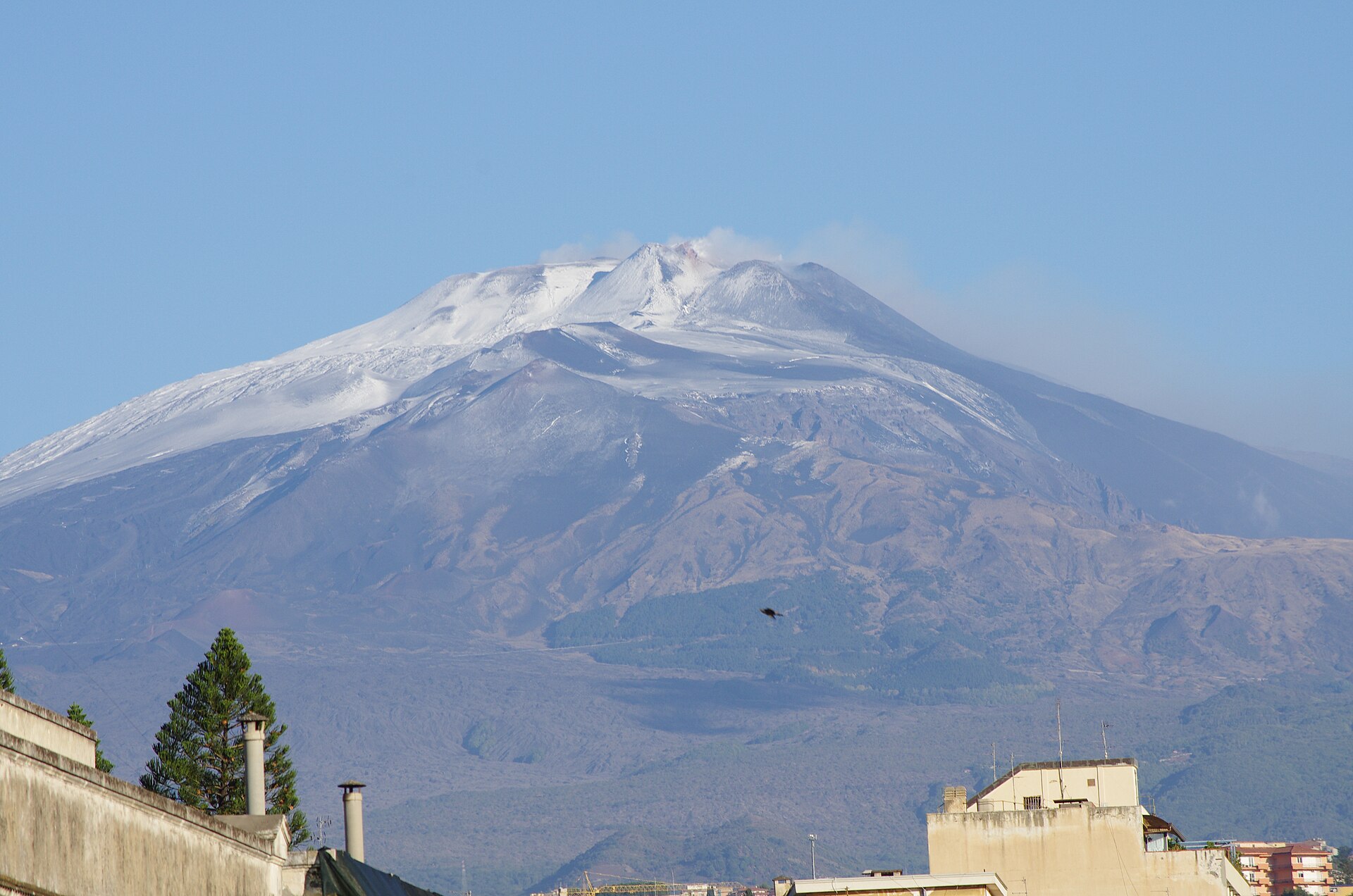
How do you get to Mount Etna from Catania?
From Catania, the only public option is the AST bus from Piazza Giovanni XXIII, departing at 8:15 a.m. and arriving at Rifugio Sapienza at 10:15 a.m. (€6.60 round-trip, return 16:30). Driving the same route takes about an hour. Guided day-tours from Catania include round-trip transfers and typically pick up at central squares between 7:30 and 8:30 a.m.
The AST bus is famously the only public transport that reaches Etna’s south base — one bus per day, leaving from the square in front of Catania Centrale railway station. Buy your ticket on board (cash) or at the small AST kiosk a few steps from the stop. The 16:30 return is your hard deadline: miss it and you’re calling a taxi from Nicolosi at extra cost. If your day-trip plan can’t tolerate that single departure, switch to a rental car or a guided tour.
Self-driving from Catania centre takes ~50–65 minutes. Pick up your rental from the airport (7 km from the centre — see our transfer from the airport guide) and follow the SP92 road through Nicolosi up to Rifugio Sapienza. Parking in Catania is the harder logistic problem if you stay overnight without a car park. At the Rifugio, parking is technically free but attendants typically expect €5 informal payment. Self-driving is the only realistic way to access the north side at Piano Provenzana: no public bus, ~85 km via the SS120, ~75 minutes.
| Mode | Time | Cost (round-trip) | Schedule | Best for |
|---|---|---|---|---|
| AST public bus | 2 h | €6.60 | One bus daily 8:15 → return 16:30 | DIY budget travellers |
| Self-drive (rental car) | 1 h | €30–50 fuel + parking | Flexible — sunset return possible | Couples, north-side access, photographers |
| Taxi (return + wait) | 1 h | ~€120 (4 pax total) | On-demand | Small groups skipping the 8:15 constraint |
| Guided day-tour | 1 h transfer | €50–150 (incl. cable car + guide) | Pickup central squares 7:30–8:30 a.m. | Time-constrained, no-car visitors |
Richard Allaway · CC BY 2.0
Choosing your side: Etna South vs Etna North
Etna South (gateway: Nicolosi → Rifugio Sapienza, 1,910 m) is the busy, infrastructure-rich side with cable car, 4×4 shuttle, summit tours and AST bus access. Etna North (gateway: Linguaglossa → Piano Provenzana, 1,810 m) is quieter, fringed by pine and birch forest, and better for solo hikers who want the lava-pine landscape — but there is no public bus.
| Criterion | Etna South (Rifugio Sapienza) | Etna North (Piano Provenzana) |
|---|---|---|
| Gateway town | Nicolosi (15 km from base) | Linguaglossa (8 km from base) |
| Base altitude | 1,910 m | 1,810 m |
| Public transport from Catania | AST bus €6.60 RT | None — car only |
| Cable car (Funivia) | Funivia dell’Etna €50 RT | None |
| 4×4 shuttle | Combo €78 (cable + 4×4 + 60-min guided walk) | Limited service via Piano Provenzana operators |
| Trail vibe | Volcanic gravel, exposed slopes, panoramic | Lava-pine forest, Pista Altomontana, intermediate |
| Crowds (peak) | High in July–August | Low to moderate year-round |
| Best for | First-timers, summit-tour buyers, families | Quiet trekkers, photographers, repeat visitors |
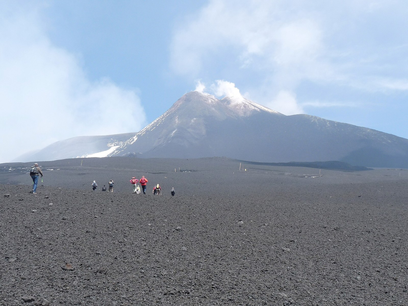
If this is your first day on Etna, default to the south. Everything is in one place at Rifugio Sapienza: car park, ticket office, cable car, food, restrooms, and the trailhead for the Crateri Silvestri loop sits just down the road at 1,900 m. Etna North is the better second visit: fewer day-trippers, a different geological feel (pine and birch surviving on lava), and access to the Pista Altomontana high-altitude route that traverses the entire north flank. The south wins for logistics, the north wins for atmosphere.
Ji-Elle · CC BY-SA 3.0
Hiking routes by difficulty
Mount Etna offers five main routes ranging from a one-hour Crateri Silvestri loop suitable for kids to a six-hour summit ascent with mandatory volcanological guide. Pick by altitude target, fitness, and whether you want a guide. All five are described below with duration, elevation gain, and cost.
| # | Route | Side | Duration | Altitude gain | Guide | Cost |
|---|---|---|---|---|---|---|
| 1 | Crateri Silvestri loop | South | 45–60 min | ~50 m (rim walk) | No | Free (parking ~€5) |
| 2 | Schiena dell’Asino | South | 3–4 h | ~600 m | No | Free (DIY) |
| 3 | Monte Nero degli Zappini | North | 3–4 h | ~400 m | No | Free; ~€5 parking Piano Provenzana |
| 4 | Valle del Bove rim | South-East | 4–5 h | ~700 m | No | Free; small parking |
| 5 | Crateri Sommitali (summit) | South | 6 h | ~1,400 m | Mandatory above 2,800 m | €78–130 combo |
Routes 1–4 are fully self-guided. Route 5 requires booking a tour: the standard combo is cable car (1,910→2,500 m) + 4×4 minibus (2,500→2,920 m) + a 60-minute guided walk to the upper craters. Plan one route per day; combining the Crateri Silvestri loop with Schiena dell’Asino is feasible if you arrive by car at 9 a.m. and leave by 16:00, but the AST bus schedule (10:15 arrival, 16:30 departure) only realistically supports a single walk plus the cable car.
Rifugio Sapienza and the Funivia dell’Etna
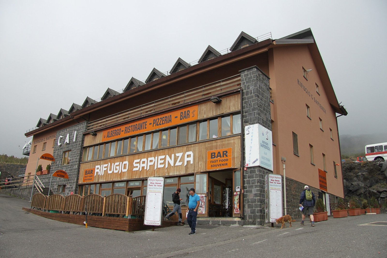
Rifugio Sapienza at 1,910 m is the practical heart of Etna South: the AST bus terminus, the Funivia bottom station, the trailhead for most routes, the only car park on the south flank, and a row of cafes, restrooms and souvenir shops. Plan the rest of your day from here.
Rifugio Sapienza
Richard Allaway · CC BY 2.0
- Location
- Piazzale Rifugio Sapienza, Nicolosi Maps
- Essential fact
- 1,910 m altitude — AST bus terminus, Funivia bottom station, trailhead for the Crateri Silvestri loop and Schiena dell’Asino.
- Price
- Free
The base hosts a small lava-museum, a Pro Loco kiosk for trail maps, and a dozen souvenir stands selling lava jewellery and Etna honey. We use it as the breakpoint between the lower forest drive and whatever route we’ve planned for the day.
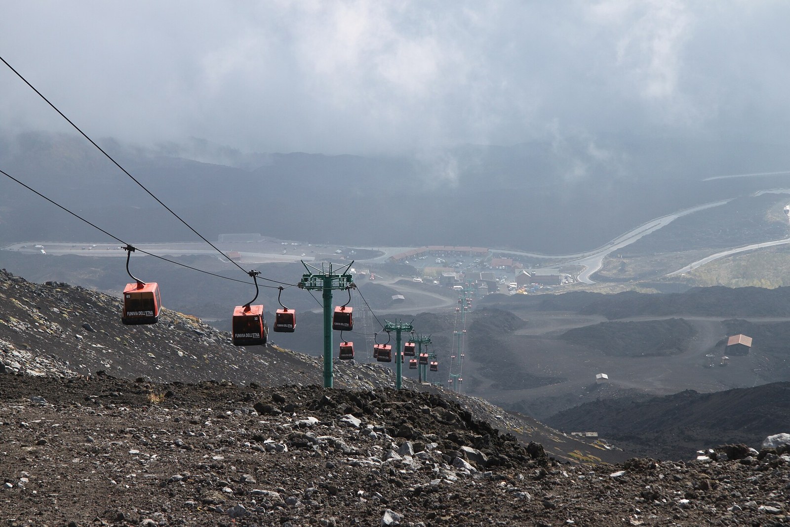
Funivia dell’Etna (cable car)
Hein56didden · CC BY-SA 4.0
- Location
- Stazione Partenza Piazzale Funivia Etna Sud, Nicolosi Maps
- Site
- funiviaetna.com
- Essential fact
- Climbs ~590 m to the upper station at 2,500 m in roughly 15 minutes.
- Price
- €50–78
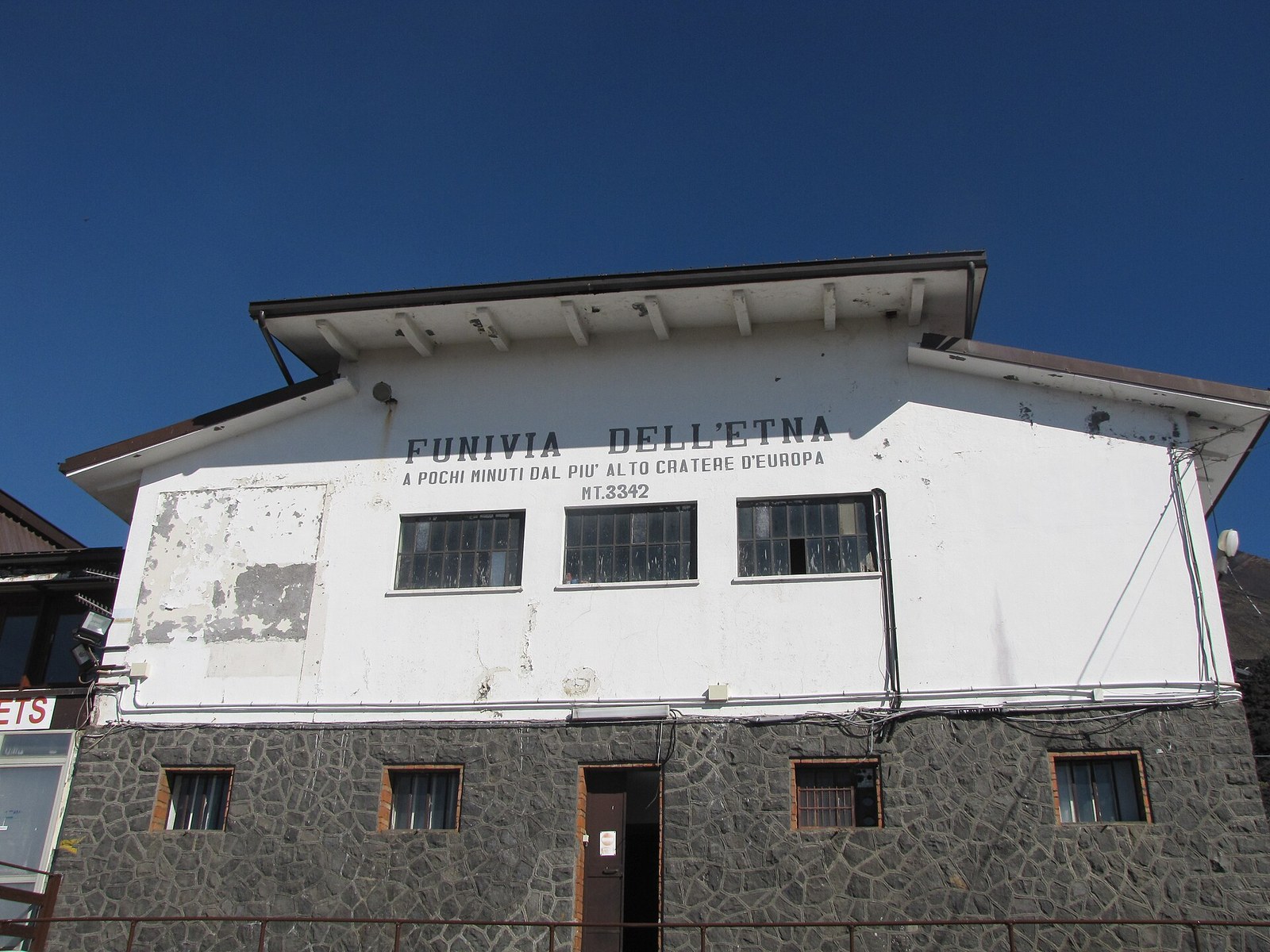
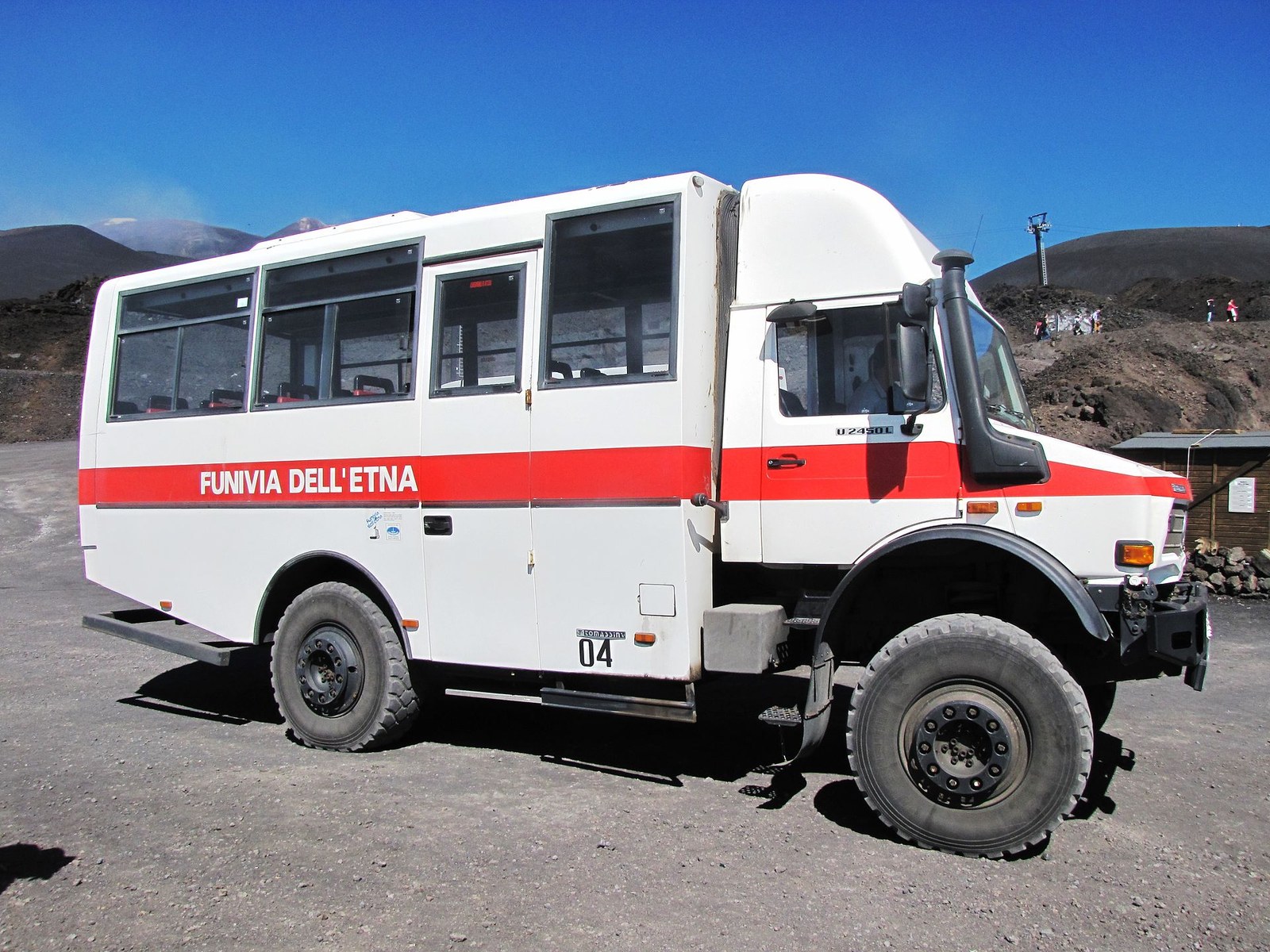
The Funivia dell’Etna is the choke-point of the south flank: every summit tour, every short visit to the upper crater belt, every “I want to feel high without walking 4 hours” itinerary funnels through it. The round-trip cable car alone costs €50 per adult — quoted by every peer guide we cross-checked, including Sicily Active, Earth Trekkers and Along Dusty Roads. Add the 4×4 minibus to 2,920 m and a 60-minute guided walk and you reach the summit-area legal limit at €78 for the combo. Children 5–10 pay €50 for the same combo. Buy at the ticket office (cash or card), no advance booking needed except in peak weeks of August and during cruise-ship days.
Two practical notes the marketing leaflets skip: jacket rental is available at the bottom station for ~€4 if you underestimate the temperature drop (and many do); and the cable car closes during high winds or active eruption phases — check Funivia dell’Etna’s social channels the morning of your visit. If the cable car is closed and you want the upper section, the alternative is the Schiena dell’Asino trail on foot from Rifugio Sapienza, ~3–4 hours up.
Piano Provenzana and the north side
Thebonobopower · CC BY-SA 4.0
- Location
- Piano Provenzana – Etna nord,via Provenzana, Linguaglossa Maps
- Essential fact
- 1,810 m altitude — rebuilt after the 2002 eruption that destroyed the original ski station.
- Price
- Free
Piano Provenzana at 1,810 m is the gateway to Etna North, reached via the SP59 from Linguaglossa. It is the quieter side, with smaller crowds, lava-pine forest at the base, and access to the high-altitude Pista Altomontana that traverses the north flank for ~40 km. There is no cable car here. There is no public bus from Catania. You drive, or you don’t. Parking is informal at ~€5; north-side 4×4 shuttles cost €30–40 per person and reach ~2,500 m on demand.
The base feels different from the moment you step out of the car: pine and birch grow on the dark lava soil up to ~1,800 m, the silence is genuine, and the dominant sound on a calm day is wind through the trees rather than tour-group chatter. Independent hikers can walk the Monte Nero degli Zappini nature trail (3–4 hours, marked) for a forest-and-lava traverse without going above 2,200 m. Operators based at Piano Provenzana run 4×4 shuttles to ~2,500 m on the north flank for those who want altitude without the south-side queue. North-side summit tours exist but are less frequent than the south; if a summit is the goal and you have one day, default to the south.
Crateri Silvestri loop: the family-friendly hike
Sayatek · CC BY-SA 4.0
- Location
- Via Catania, Nicolosi Maps
- Essential fact
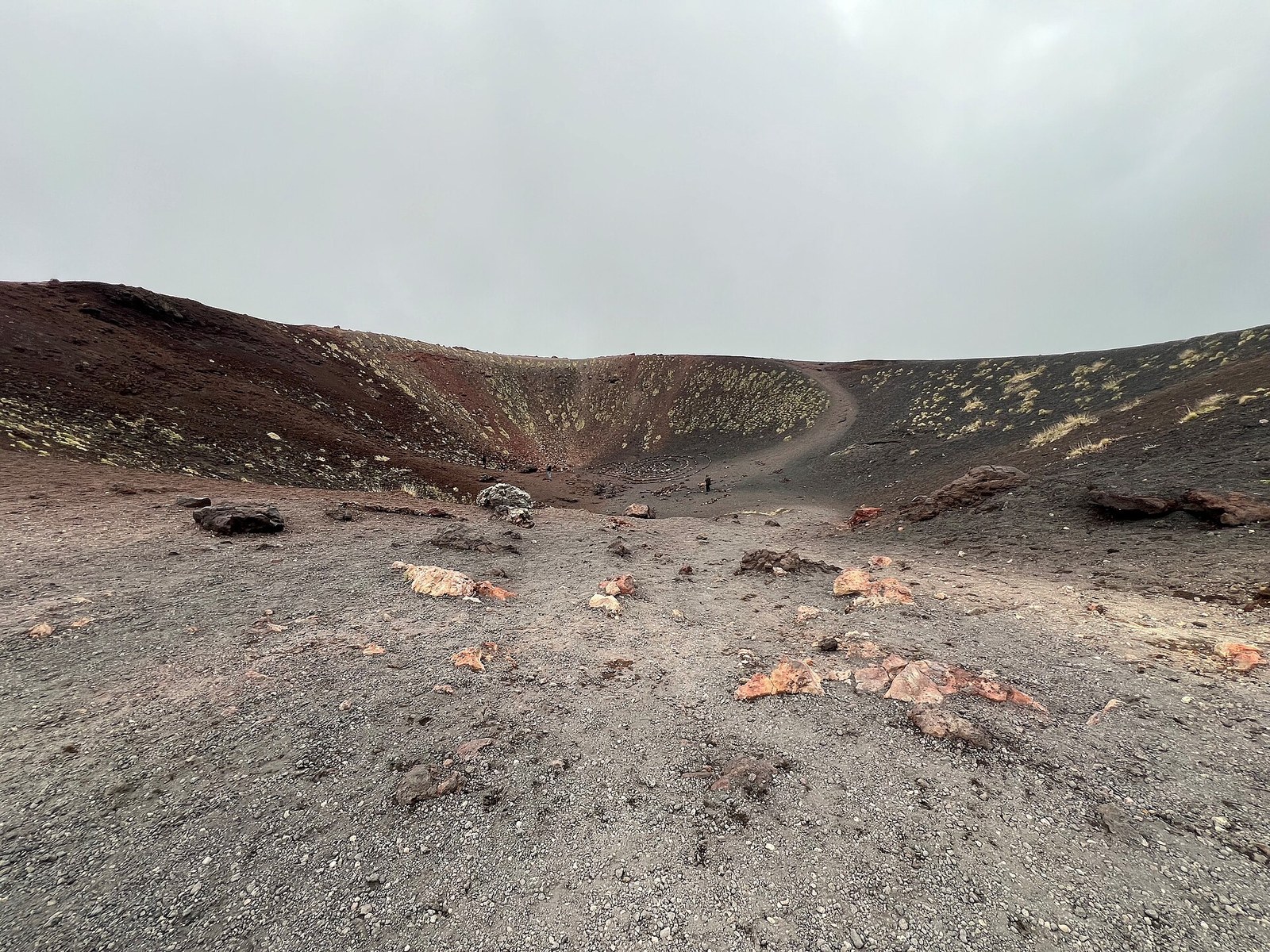
- Cluster of extinct craters at ~1,900 m formed in the 1892 eruption — the easiest legal hike on Mount Etna.
- Price
- Free
The Crateri Silvestri are a cluster of extinct craters at 1,900 m formed during the 1892 eruption, a 5-minute drive (or 10-minute walk) below Rifugio Sapienza on the SP92. The rim loop is the easiest serious hike on Mount Etna — well-marked, no altitude gain to speak of, suitable for kids 6+ and for travellers who want “a taste of Etna” without committing to a half-day. Allow 45–60 minutes for the rim circuit, longer if you climb the optional cone for the panorama south to Catania and the Ionian. The trail surface alternates compact volcanic ash and fragmented basalt — trail-running shoes are fine here, mid-cut hiking boots overkill. Bring a warm layer regardless of the weather at the bottom: temperatures at 1,900 m can be 8–10 °C cooler than Catania, and the wind picks up sharply when cloud rises from the Valle del Bove. This is the loop we recommend to first-time visitors travelling with kids who still want to say they walked on Etna.
Valle del Bove viewpoint and Schiena dell’Asino
Walkabout 88 · CC BY-SA 4.0
- Location
- Zafferana Etnea, Metropolitan city of Catania Maps
- Essential fact
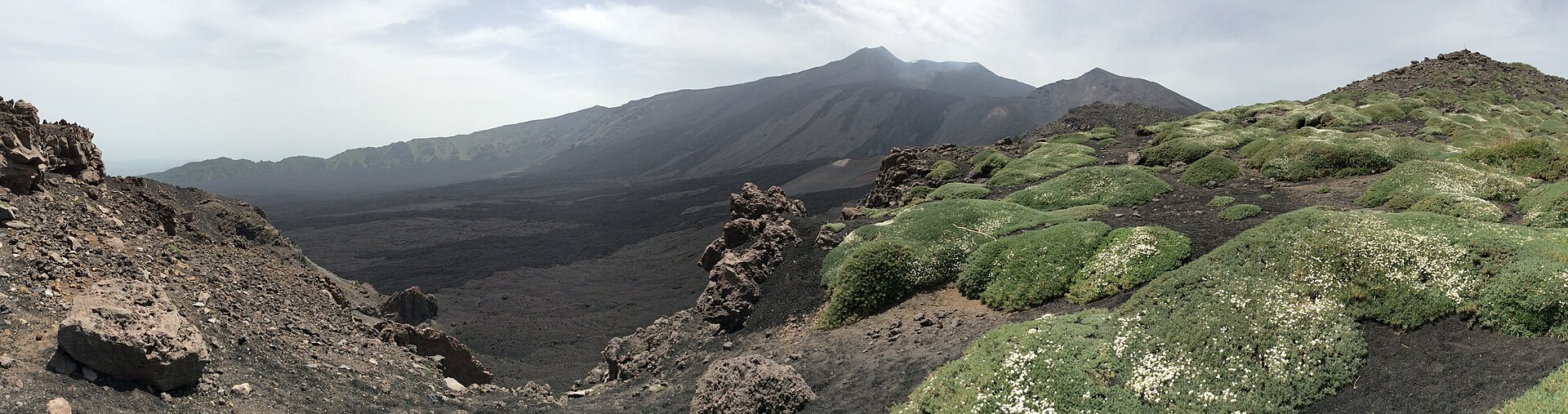
- Horseshoe-shaped collapse caldera ~7 km wide, 5 km long, formed ~64,000 years ago and partly filled by historic lava flows.
- Price
- Free
Valle del Bove is the dramatic eastern collapse caldera of Mount Etna — a horseshoe-shaped depression ~7 km wide and 5 km long, ringed by 1,000-metre-high cliffs and floored by black lava from successive eruptions. You don’t hike into it (the floor is unstable and partially closed); you walk to the rim, and the view does the rest of the work.
The classic access is the Schiena dell’Asino (“donkey’s back”) trail from Rifugio Sapienza: a 3–4 hour round-trip moderate hike that climbs ~600 m to a panoramic ridge with the full caldera unfolding to the east. The 2002 lava flow is visible from the rim, distinct from older flows by its darker, fresher black. Continue along the ridge if you want a longer day — experienced hikers can extend to Pizzi Deneri at ~2,800 m, the highest legal point without a guide. We rate this the best self-guided half-day on Etna: scenery hard to match anywhere else in Sicily, and you’ve earned the descent rather than ridden it.
Reaching the summit: when you need a guide
Above 2,800 m the summit area requires a certified mountain or volcanological guide. Most summit tours combine the Funivia dell’Etna cable car (1,910→2,500 m), a 4×4 minibus shuttle (2,500→2,920 m), and a guided 60-minute walk to the Barbagallo Craters at the edge of the Crateri Sommitali. The combo ticket is €78 per adult.
Hein56didden · CC BY-SA 4.0
The standard summit-area experience runs like this: take the cable car up at 9:00 or 10:00 a.m., transfer to the 4×4 minibus, ride 25 minutes to ~2,920 m, then walk with a volcanological guide for 60 minutes around the rim of the Barbagallo Craters formed in the 2002–2003 eruption. Some tours push closer to the historic Torre del Filosofo shelter at ~2,900 m, partly buried by the same eruption. Genuinely reaching the active summit craters at ~3,300 m requires a longer “summit trekking” tour with a private volcanological guide and 4–5 hours on foot from the cable-car upper station. Those run €80–130 per person.
Cayambe · CC BY 4.0
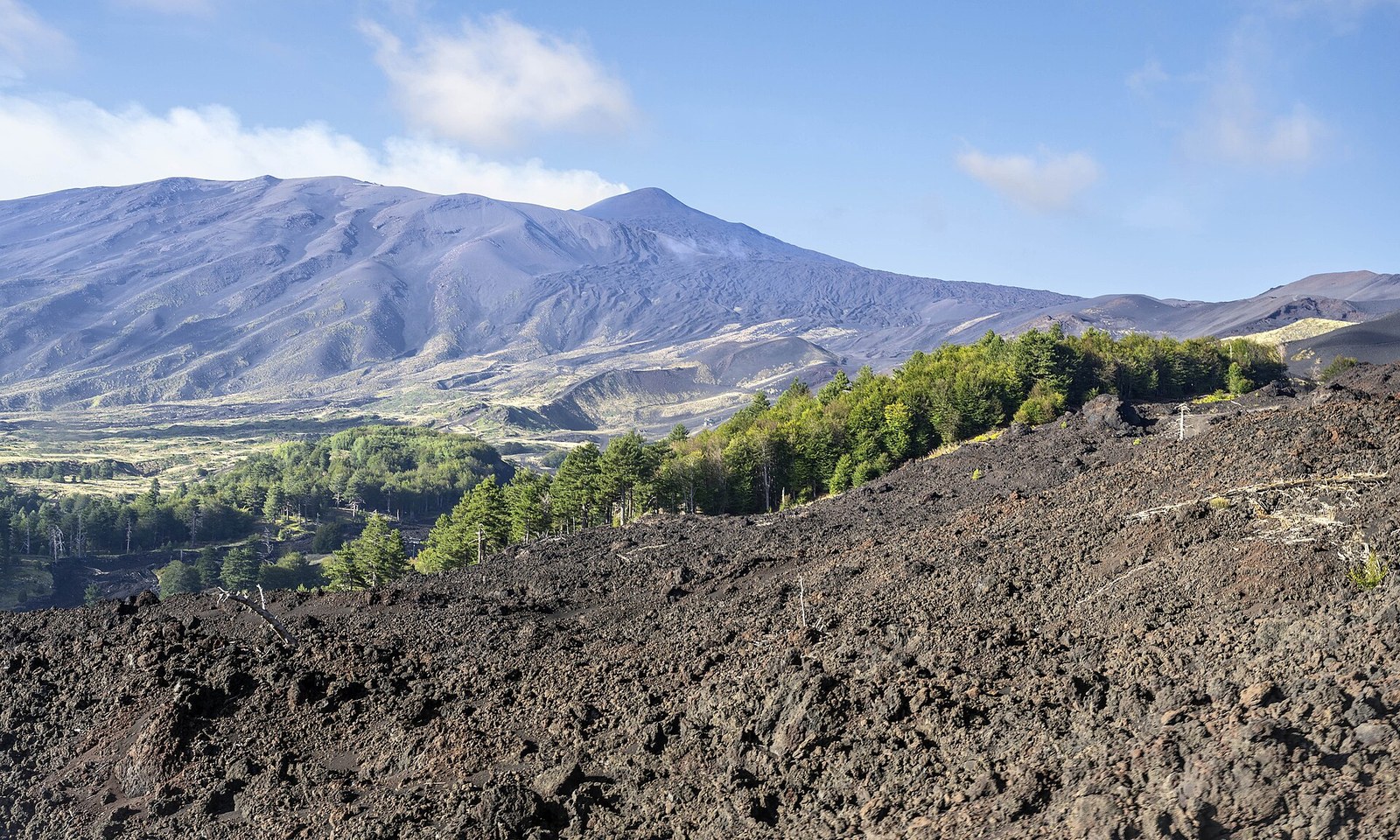
Why the rule exists is worth restating: Etna’s summit configuration changes after each paroxysmal phase. New cones grow, fissures open, gas plumes shift direction. The certified guides train with the INGV (Italian National Institute of Geophysics and Volcanology) and read the mountain in real time. Below 2,800 m you can be self-sufficient with a map, water and respect; above 2,800 m the variables exceed what any visitor can read alone. If the summit is your reason to come to Sicily, book the tour, accept the cost, and accept that the Funivia or the trip can be cancelled at short notice for weather or activity. Pair the visit with Etna wine tours on the lower slopes if you want to round out the day.
How much does it cost to hike Mount Etna?
A DIY hike using AST bus, cable car and self-guided walk to 2,800 m costs about €68–100 per person. A guided summit day-tour from Catania (transfer + cable car + 4×4 + volcanological guide) ranges €80–150 per person. Add ~€4 for jacket rental at Rifugio Sapienza if temperatures drop below freezing.
| Scenario | AST bus | Cable car | 4×4 + guide | Tour transfer | Total per person |
|---|---|---|---|---|---|
| Budget DIY (Crateri Silvestri loop, no cable car) | €6.60 | — | — | — | €6.60 |
| DIY classic (cable car to 2,500 m, walk to 2,800 m) | €6.60 | €50 | — | — | ~€57 |
| Self-drive + summit combo | €30 (fuel + parking) | — | €78 (combo) | — | ~€108 |
| Premium guided day-tour from Catania | — | included | included | €80–150 | €80–150 |
Three numbers most peer guides agree on as of April 2026: cable car only €50 round-trip, combo (cable + 4×4 + 60-min guide) €78, AST bus round-trip €6.60. Lunch at Rifugio Sapienza adds €15–25 for a basic plate at the cafeteria; bring a packed lunch if you want to budget below that. Children 5–10 pay reduced cable-car rates (€25 RT cable only, €50 combo). Above 10 they pay the adult tariff. Pre-booking online via the official Funivia dell’Etna site is possible but not necessary outside of August peak.
When is the best time to hike Mount Etna?
April–May and late September–October are the sweet spot. Snow has melted from the upper craters, summit access is fully open, and crowds are far lighter than July–August. Winter brings ski conditions on the upper slopes; summer guarantees access but means heat at the base and queues at the Funivia.
Detail by season. Spring (April–May): snow lingers above 2,500 m through April most years — the cable car runs, the Crateri Silvestri loop is bare, the Schiena dell’Asino trail can have snow patches above 2,300 m. Bring waterproof boots if you’re going above the cable-car upper station. Summer (June–August): full operation, no snow, but Catania hits 33–36 °C, the Funivia queue can stretch 30 minutes on cruise-ship days, and the cafeteria runs out of food by 13:00 in August. The summit area is at its most accessible. Autumn (September–October): in our view the best window. Crowds drop sharply after 15 September, daytime highs at the base are 18–25 °C, the upper craters are still snow-free, and the light is photographically excellent. Pair the visit with Sicily in October shoulder-season planning. Winter (December–March): ski conditions on Etna North (Piano Provenzana operates lifts), summit closed periodically, the south remains accessible up to the cable-car bottom station with proper gear.
Eruption disruption is the wildcard. Active phases are the norm rather than the exception, and most do not affect tourist access — the summit area may close for a day or two while the volcano vents through a new fissure, then reopens. Major events (large lava flows, ash columns over Catania airport) are rarer and announced in advance by INGV. Always check Funivia dell’Etna’s social channels and INGV bulletins the morning of your hike.
Is hiking Mount Etna worth it?
Yes. Hiking Mount Etna is one of the most distinctive day-trips from Catania — Europe’s tallest active volcano with accessible routes from a 45-minute Crateri Silvestri loop at 1,900 m to a full summit-area excursion at 2,920 m via cable car and 4×4. Views span the Aeolian Islands, the Ionian coast and inland Sicily; the 2,800 m altitude limit for unguided hikers keeps independent visits safe.
Match the route to your party: families do Crateri Silvestri in trainers, fit hikers tackle Schiena dell’Asino (3–4 h, 600 m gain), and summit-seekers book a volcanological guide for the 2,920–3,357 m band (a€~110–130). The honest caveats: August can mean 33 °C at the base plus 30-minute Funivia queues on cruise-ship days, and active eruptive phases occasionally close the summit area for a day or two — check INGV bulletins the morning of your hike.
What to wear and pack
Mount Etna is at altitude. Even in July, the summit area can drop to 5–10 °C, and a strong wind makes that feel like 0 °C. Plan for a 10 °C drop per 1,000 m of elevation gain compared to your starting temperature in Catania. For a dedicated clothing checklist by season, altitude and visit type, see our guide to what to wear on Mount Etna.
- Clothing: layered base, light fleece, windbreaker or shell, hat, neck buff. Even in July at the summit. In April–May add a warm mid-layer.
- Footwear: trail-running shoes acceptable for the Crateri Silvestri loop only. Mid-cut hiking boots for Schiena dell’Asino, Monte Nero, Valle del Bove rim. Waterproof boots for any spring snow above 2,300 m.
- Safety: 1–2 L water (no springs above 1,300 m), high-altitude UV sunscreen, sunglasses, dust buff for windy days when ash is suspended.
- Extras: trekking poles helpful if you go above 2,500 m, cash €20–50 for informal parking and jacket rental, national ID or passport for the combo cable-car ticket scan.
What we don’t pack: heavy down jackets (overkill below 2,500 m even in winter unless skiing), full mountaineering boots (Etna trails are technical only above 2,800 m where you have a guide who provides crampons if needed), large daypacks (a 20–25 L bag is plenty). And one Etna-specific item: a rain cover for your camera or phone in spring — volcanic ash plus light rain creates a black gritty paste that ruins lens coatings.
Do you need a guided tour?
If you want the summit area (above 2,800 m), a guide is mandatory. For routes below 2,800 m — Crateri Silvestri, Schiena dell’Asino, Monte Nero degli Zappini, Valle del Bove rim — a guide adds value but is optional. The decision turns on cost, time and how much volcanological context you want.
Go DIY when: you have a rental car or you can catch the AST 8:15 bus, you want flexibility on pace and lunch timing, you’ve hiked above 1,500 m before, you’re comfortable navigating with a phone map, and you’re aiming for routes 1–4 in the difficulty table above. Book a guide when: the summit area is the goal, you have one day and want zero logistics, you want context on lava petrology and recent eruptions that you can’t get from signage, you’re solo and prefer not to drive an unfamiliar mountain road, or your group includes someone who needs slower-paced reassurance at altitude.
For guided tours, booking direct with operators (Sicily Active, Go-Etna, Etna Experience and others — we don’t recommend specific operators in this guide) typically saves 10–20 % versus aggregator platforms like Viator or GetYourGuide. The aggregators offer easier cancellation and English-only support filters, which can be worth the markup. Same logic applies to Etna wine tours: direct often cheaper, aggregator more flexible. Decide based on whether you need the cancellation safety net.
Where to stay in Catania for an Etna day-trip
Catania centro is the natural base for a Mount Etna day-trip. The AST bus to Rifugio Sapienza leaves from Piazza Giovanni XXIII, immediately in front of Catania Centrale railway station — a 10-minute walk from Piazza Duomo and the cathedral. Rental-car pickup is at the airport 7 km south. Restaurants stay open late enough to handle a 17:00 return, and you can pair the hike with a relaxed evening on Via Etnea or in the old town. The same base also covers things to do in Catania, the day-trip to Taormina, and the seafood lunch at the Pescheria fish market between hike and aperitif.
For UK visitors planning a longer stay, our complete Catania holiday guide covers context. For a longer Sicily itinerary that includes Etna as one stop, see our 7-day itinerary including Etna. After dark the city scene is in Catania nightlife; for a day trip with a romantic angle (Etna at sunset is unforgettable), see Sicily honeymoon — it covers the Etna sunset stop in day 3. Where to stay in Catania is the deeper accommodation guide.
If you’d like to base in the old town within walking distance of the AST bus stop, the cathedral, and the airport shuttle, we host three apartments in Catania centre — Etna, Ionio and Zagara — in the same building near Piazza Duomo. They are sized for 2–4 guests, with the AST bus stop a 10-minute walk away.
August is the optimal high-altitude trekking window on the volcano — see our Sicily in August guide for the full month context: snow-zero, summit air 5-15°C, very low wind, and the chance to spend midday in cooler air while Catania sits at 32°C.
For the optimal Etna trekking months pre-August, see our Sicily in June guide (snow patches above 2.500 m through early June, broom in bloom 1.500-2.000 m, summit 5-15°C) and our Sicily in July guide (snow-zero on all routes, summit 8-18°C, lower wind probability than August).
Etna’s ski season runs from late December to mid-March — for winter visits when the volcano is snow-capped see our Sicily in January guide for ski-station details and quiet-season planning.
The information in this guide was correct at the time of writing. Data can change from season to season without notice: before you travel, always check the official channels and websites for updates. We review this guide periodically, but the official channels are always the authoritative source. We also cannot guarantee that the suggested routes or the attractions described are always reachable or accessible: roads, trails and sites may be closed, damaged, altered or unsafe. Assessing the practicability and safety of itineraries and attractions always remains your own responsibility.